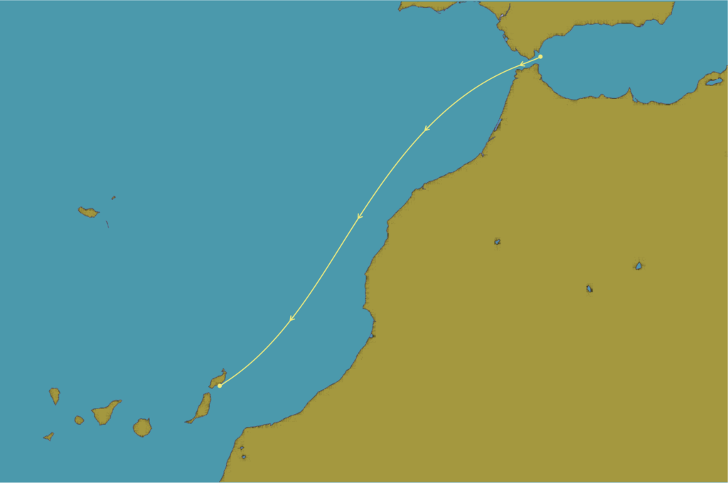
Starting from the start line South of the Punta Grande de Europa headland the route navigates the Straits of Gibraltar before heading South West out into the Atlantic Ocean running down the Western coast of Morocco. The last quarter of the course provides a tacticians conundrum, navigating the wind acceleration zones and traversing the Lanzarote coastline making an optimum approach to the finish line off the Puerto Calero breakwater.